 BGS Data Catalogue
Mineral resources
Type of resources
Available actions
Topics
Keywords
Contact for the resource
Provided by
Years
Formats
Representation types
Update frequencies
Service types
Scale
-

A card index storing supplementary information regarding name, operator, dates and commodity worked for each planning permission boundary recorded (drawn) on the Ministry of Housing and Local Government (MHLG) Mineral Planning Permissions Maps (see associated metadata). Information on the cards has been used to attribute the Ministry of Housing and Local Government (MHLG) Mineral Planning Permission Polygons (see associated metadata for MHLG Planning Permission Polygons).
-

Digital GIS mineral planning permission polygons from 1947 to 1985 as digitised from the Ministry of Housing and Local Government Planning Permission Maps and Cards (see associated metadata for MHLG Maps, Cards and Scanned Maps ). Data digitised included all planning permissions granted, withdrawn and refused for local authority areas for all of England. Currently 32,000 separate planning permission polygons have been captured from the maps and attributed using the associated card index.
-
These are OS 1:25000 paper maps (approximately 1400) upon which the Ministry of Housing and Local Government (currently Department for Communities and Local Government (CLG)) recorded hand drawn boundaries for permitted, withdrawn and refused mineral planning permissions and worked ground for every local authority area in England. Accompanying the maps is an associated card index (see metadata for MHLG Cards). Priority was placed on areas that were given rise to then current casework issues thus, at the time when the maintenance of the maps ended some authority information had been updated recently but other areas had not been visited for many years. Therefore, the variable completeness of the data should be kept in mind when the material is being used. Both the maps and the card index have been used to create the digital mineral planning permissions polygons (see metadata for MHLG Planning Permission Polygons). Polygons for worked ground have not been captured.
-
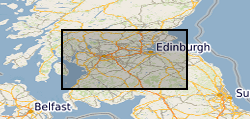
The original version of this dataset contained lithologies interpreted as representing a mineral resource for mineral extraction. Collated on a County by County basis as part of the former Office of the Deputy Prime Minister (ODPM) Mineral Resource Information in support of National Regional and Local Planning between 1994 and 2006. A primary objective is to produce baseline data in a consistent format that can be updated, revised and customised to suit planning needs, including Mineral Local Plans and Regional Planning Guidance, as well as those of industry. The BGS Mineral Resource data does not determine mineral reserves and therefore does not denote potential areas of extraction. Only onshore, mainland mineral resources are included in the dataset. This dataset has been produced by the collation and interpretation of mineral resource data principally held by the British Geological Survey. The mineral resource data presented are based on the best available information, but are not comprehensive and their quality is variable. The dataset should only be used to show a broad distribution of those mineral resources which may be of current or potential economic interest. The data should not be used to determine individual planning applications or in taking decisions on the acquisition or use of a particular piece of land, although they may give useful background information which sets a specific proposal in context. During 2011-2012 revisions were made to areas of the resource linework. These changes were made as a result of new research and release of a new version of DiGMap (v5). This work was on an ad hoc basis but affects all resource layers. The paper maps were not re-released with this data update.
-
Several coal resource maps for the whole of the UK have been produced by the British Geological Survey as a result of joint work with Department of Trade and Industry and the Coal Authority. The UK Coal Resource for new exploitation technologies map is a map of Britain depicting the spatial extent of the principal coal resources overlayed with existing workings and potential new technologies for accessing the resource. The map also shows the areas where coal and lignite are present at the surface and also where coal is buried at depth beneath younger rocks. The project covers all onshore coalfields in the UK, including Northern Ireland. It includes coal under estuaries and near-shore areas that can practically be reached by land-based directional drilling. No data more than 5 km offshore were considered. The maps are intended to be used for resource development, energy policy, strategic planning, land-use planning, the indication of hazard in mined areas, environment assessment and as a teaching aid. In addition to a summary map at 1:750000 scale for Britain data also exists for each technology of 21 individual regions or coal fields at a scale of 1:100000. The data was published in printed map form for the summary map, inkjet plots for the 42 individual maps and as PDF documents on CD. The maps were accompanied by BGS report CR/04/015N, "UK Coal Resource for New Technologies, Final Report". The work was initiated in April 2002 and completed in October 2003. The data was also simplified for inclusion in the Britain Beneath your Feet atlas 2005.
-

The map show the broad distribution of the industrial, including construction, mineral resources of Britain and the main sites where these are worked. Over extensive areas bedrock is covered by superficial deposits, including economically important sand and gravel resources. These superficial deposits are not shown on the map. Resources have been defined by dominant lithology (rock type). The map is a synthesis of the mineral resources and mineral working data held by the BGS in 1996. The published (paper) map has not been superseded however the digital mineral resources and mineral workings data has since been superseded. The map is logically consistent throughout.
-
'Archive' collection of c.3,000 records of the former Industrial Minerals Assessment Unit (IMAU) relating to sand and gravel assessment projects in Scotland, 1978-88. Includes borehole and trial pit records, grading and resource assessment data and aggregate tests.
-

Coal resource maps for the whole of the UK have been produced by the British Geological Survey as a result of joint work with Department of Trade and Industry and the Coal Authority. The Coal Resources Map is a Map of Britain depicting the spatial extent of the principal coal resources. The map shows the areas where coal and lignite are present at the surface and also where coal is buried at depth beneath younger rocks. The maps are intended to be used for resource development, energy policy, strategic planning, land-use planning, the indication of hazard in mined areas, environment assessment and as a teaching aid. In addition to a general map of coal resources for Britain data also exists for the six inset maps: Scotland; North-East; North-West; East Pennines; Lancashire, North Wales and the West Midlands; South Wales, Forest of Dean and Bristol. Available as a paper map, flat or folded, from BGS Sales or as a pdf on a CD if requested.
-
The British Geological Survey (BGS) was awarded a grant from the Scottish Government Aggregates Levy Fund in 2007 to provide a comprehensive, relevant and accessible information base to enhance the sustainability of mineral resources for 18 local authorities in the central belt of Scotland. BGS co-funded this project through its Sustainable Mineral Solutions project. This work was completed in March 2008. This dataset comprises the digital GIS files which were produced through this project. The major elements of minerals information presented are the geological distribution of all mineral resources in the Central Belt of Scotland. The BGS Mineral Resource data does not determine mineral reserves and therefore does not denote potential areas of extraction. Only onshore, mainland mineral resources are included in the dataset. This dataset has been produced by the collation and interpretation of mineral resource data principally held by the British Geological Survey. The mineral resource data presented are based on the best available information, but are not comprehensive and their quality is variable. The dataset should only be used to show a broad distribution of those mineral resources which may be of current or potential economic interest. The data should not be used to determine individual planning applications or in taking decisions on the acquisition or use of a particular piece of land, although they may give useful background information which sets a specific proposal in context.
-
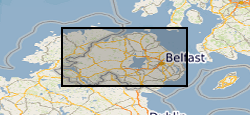
This mineral resource data was produced as part of the Mineral Resource Map of Northern Ireland via a commission from the Northern Ireland Department of the Environment. The work resulted in a series of 21 data layers which were used to generate a series of six digitally generated maps. This work was completed in 2012 with one map for each of the six counties (including county boroughs) of Northern Ireland at a scale of 1:100 000. This data and the accompanying maps are intended to assist strategic decision making in respect of mineral extraction and the protection of important mineral resources against sterilisation. They bring together a wide range of information, much of which is scattered and not always available in a convenient form. The data has been produced by the collation and interpretation of mineral resource data principally held by the Geological Survey of Northern Ireland and was funded via a commission from the Northern Ireland Department of the Environment. These layers display the spatial data of the mineral resources of Northern Ireland. There are a series of layers which consist of: Bedrock: Clay, Bauxitic clay, Coal & Lignite, Coal – lignite proven, Conglomerate, Dolomite, Igneous and meta-igneous rock, Limestone, a 100m buffer layer on the Ulster White Limestone, Meta-sedimentary rocks, Perlite, Salt, Sandstone and Silica Sand. Superficial (unconsolidated recent sediments) : Sand & gravel and Peat. The data except for the salt and proven lignite resource layers was derived from the 1:50 00 and 1:250 000 scale DigMap NI dataset. This version of the data retains the internal geological boundaries which are dissolved out in the accompanying dissolved version. A user guide 'The Mineral Resources of Northern Ireland digital dataset (version 1)' OR/12/039 describing the creation and use of the data is available.